18th Century

From Buckland Farm to Buckland

Buckland stands within the “Broad Run Tract” originally owned by the sixth Lord Fairfax, who conveyed the land to his agent, Robert (King) Carter. Carter conveyed the land to his sons, who sold 1150 acres straddling Prince William and Fauquier Counties to Walker Talliaferro. Samuel Love purchased the land, including a newly constructed grist mill on Broad Run, from Talliaferro in 1774 on the eve of the Revolutionary War. He named the plantation Buckland Farm.

Love soon began construction of the main house, a single pile stone residence commonly attributed to architect William Buckland, though this affiliation is not documented. 

Buckland Hall
Buckland Hall built by Samuel Love c. 1774. Remolded and expanded by John Love c. 1815.
1759 map of dividing line that partitioned Prince William County to created Fauquier County shows residents and roads.

Samuel was of the fourth generation of the Love family that emigrated from England to the Maryland colony about 1660, settling in the area that became Saint Mary’s County. He was a leader in the county’s Revolutionary War committees, which delayed his moving from Maryland. Two of his sons, Samuel Jr. and John, served in Virginia regiments during the war. Two other sons, Charles and Augustine, likely served in county militia.

After the war the sons helped transform Buckland into a vibrant mercantile center. Beside the mill, and at the base of the lane leading to the main house, they built an assortment of secondary structures for production of farm goods. Soon, the distillery, stone quarry, blacksmith, tannery, and stores were operating and were frequented by travelers. Outside merchants arrived, leased adjoining parcels and built stores of their own.

When Samuel Love died in 1787, John inherited the main house and, with Charles, half shares of the land and mill. A few years later John purchased Charles’ half shares to become sole owner of Buckland Farm. By the end of the eighteenth century there were additional shopkeepers, a wheelwright, cooper, apothecary, boot/shoe manufacturer, saddler, woolen factory, two taverns, and a church – the essentials of a small town.

Schematic representation of Buckland’s original 48-lot plan. Mill Street extends from the mill to the gate of the manor house, Buckland Hall.

The Town of Buckland

In 1797 by petition to the Virginia General Assembly, John Love laid out a grid of lots around the irregular cluster of earlier shops and outbuildings described in the petition as “already built upwards of twenty good houses occupied by tradesmen and merchants; considerable manufactories of grain have been erected,” including a stone distillery on Lot Number 29. The petition further recommended “Buckland as a proper place for establishing a town and possessing singular advantages over any other situation within a considerable distance.” The petition also carefully enumerated all of the natural amenities afforded at this location.  The General Assembly established the “forty-eight Lott Plan of the Town of Buckland” on 15 January 1798.

Buckland is a rare American example of the familiar axial English village pattern. The main street, Mill Street, extending a half mile from the mill to the manor house entrance gate .

  A Brief History Of The Land: 1659 To 1774

Slide 2

Forty-two years after the founding of the Virginia Colony, King Charles II in 1659, granted to six loyal supporters rights to ...

Slide 3

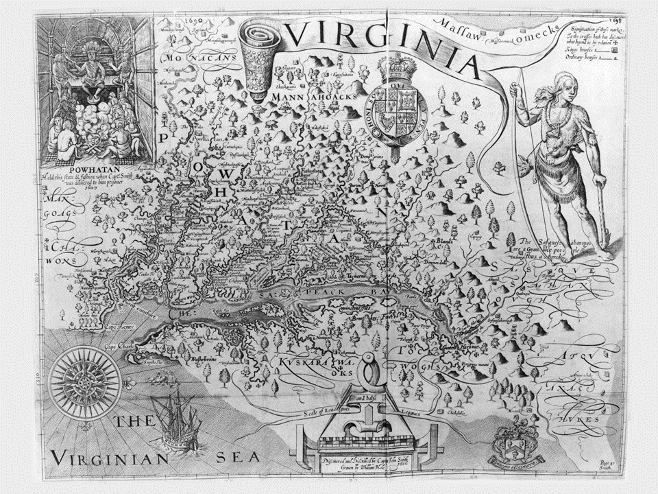
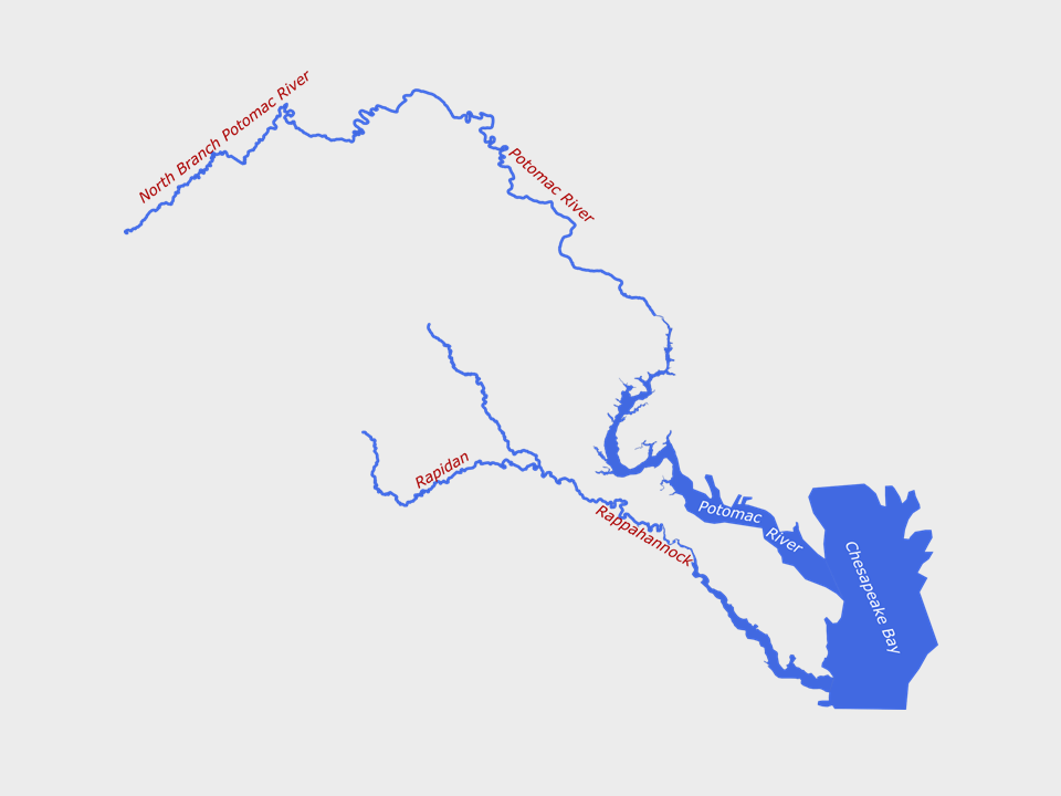
All the land in the colony lying between the Chesapeake Bay and the Potomac and Rappahannock rivers.

Slide 4

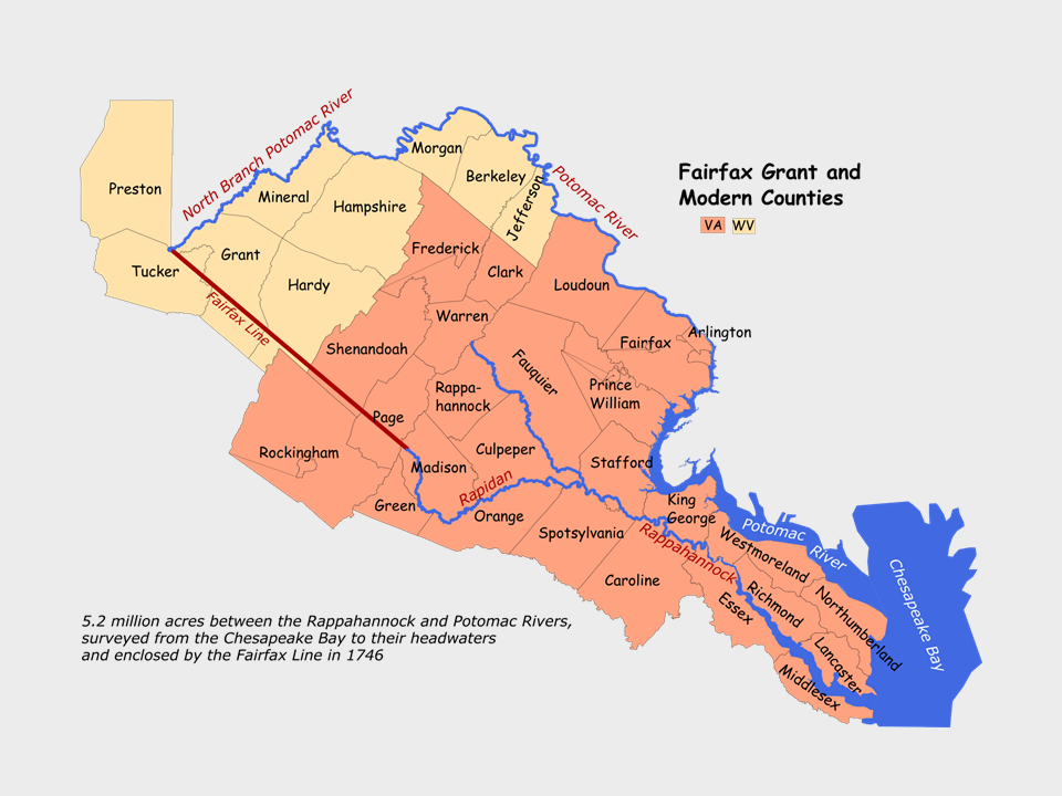
Five million acres, shown here in relation to today’s Virginia and West Virginia counties. Through deaths and marriages, title passed in 1719 to Thomas Fairfax, the 6th Lord Fairfax. Originally named the Northern Neck Grant, it was also called The Fairfax Grant. 

Slide 5

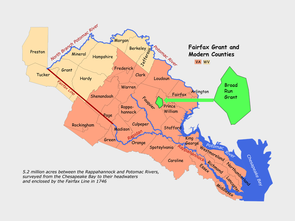
In 1724, Lord Fairfax's land agent, Robert "King" Carter, sold the Broad Run grant to his sons John and Charles Carter. 12,285 acres straddling Broad Run and the border later established in 1759 between Fauquier and Prince William Counties.

Slide 6

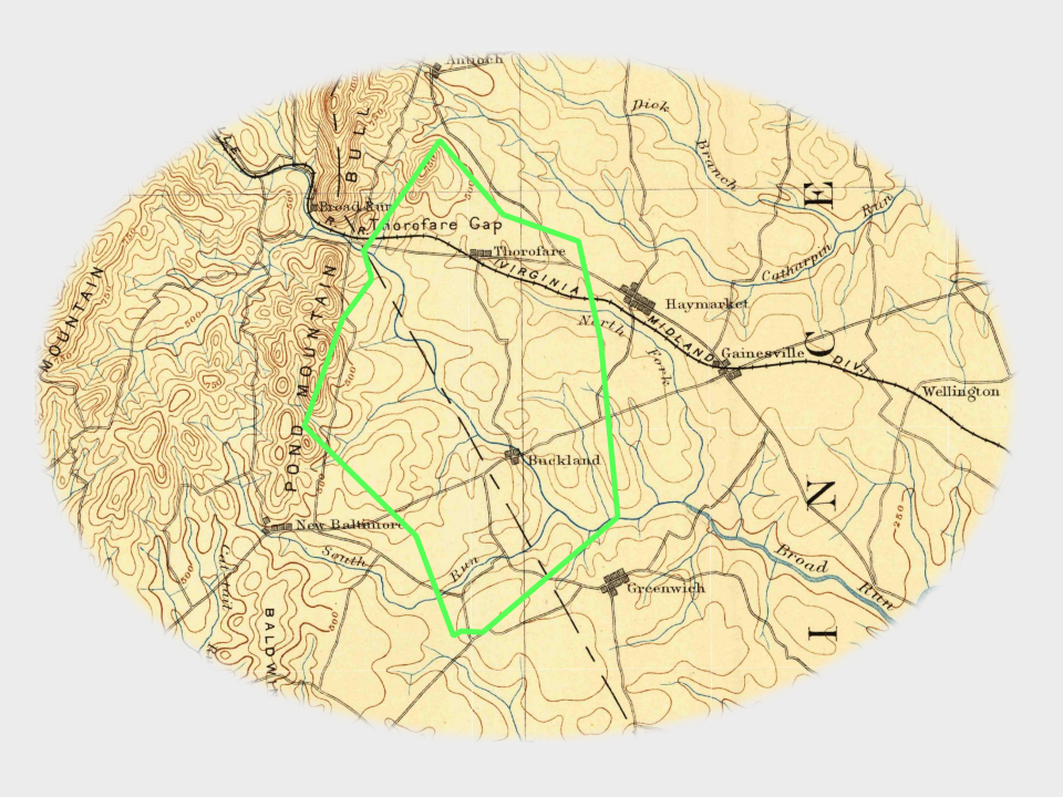
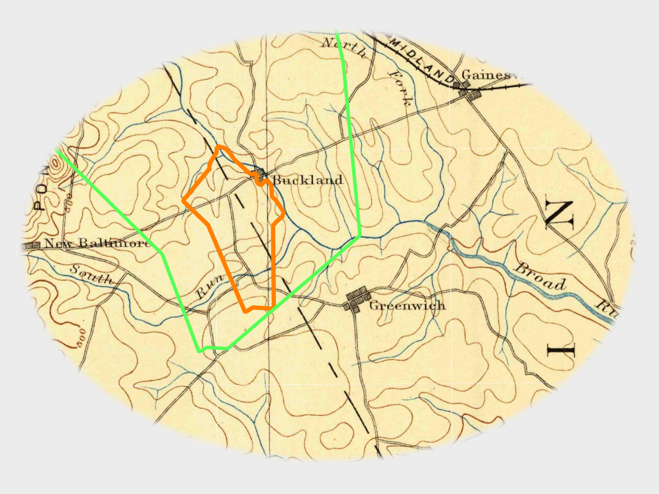
The Broad Run Grant is shown in green outline here on an 1894 topographic map in relation to communities established in the ensuing years.

Slide 7

In 1771 Walker Taliaferro purchased from Charles Carter's estate 1120 acres bordering Broad Run, outlined in orange, which he sold to Samuel Love in 1774.

previous arrow
next arrow