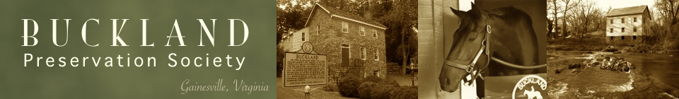
Field Reports
The Buckland Preservation Society has commissioned archaeological, architectural and historical research projects to discover, document and preserve evidence of Buckland’s development and important structures and artifacts. These reports by expert professionals give deep insight useful to educators, students, preservationists, historians and interested readers. Here below you will find a short synopsis or introduction to each report with a link to access the full report.
Look for this clickable icon

to access directly-related reports on specific topics throughout our website.
Reports on This Page
Buckland
The Battlefield
Fauquier and Alexandria Turnpike
The Entrepreneurial Landscape of A Turnpike Town: An Architectural Survey of Buckland
The Entrepreneurial Landscape of A Turnpike Town: An Architectural Survey of Buckland, Virginia
Orlando Ridout V
Alfredo Maul
Willie Graham
With contributions by
David William Blake
Stephen Fonzo
A Project of the Buckland Preservation Society
Buckland, Virginia
2005
Executive Summary
The principal goal of the current architectural survey project has been to conduct rigorous investigation of each building within the existing historic district and link the architectural evidence to the greatly expanded documentary evidence. Fifteen buildings were examined in detail, and most can now be dated within a tight range of from one to ten years. The tightly defined building dates have made it possible to make construction attributions to specific owners and sometimes to specific builders, and to draw conclusions regarding the principal uses of the buildings over the course of time. Thirteen of the fifteen buildings studied may be considered highly significant to the early history of Buckland; two more date to the 1950s, built in response to the expansion of Route 29. While modest in number, these thirteen buildings form a remarkable record of the diverse nature of an industrial and commercial turnpike town. Here are found the last extant grist mill in Prince William County, one of just three antebellum churches in the county, two taverns, two commercial stores (one an early post office), the homes of a succession of millers, two blacksmiths, two doctors, a tanner, and perhaps rarest of all, the ca. 1820 home of free African American Ned Distiller.
A further goal of this project was to identify potential archeological sites within the existing historic district boundaries. More than two dozen sites have been identified, including the sites of two blacksmith’s shops, a distillery, a tanyard, a woolen mill, dam and mill race, and the house site of free African Americans Samuel and Celia King. Also extant are the stone abutments for the timber bridge built across Broad Run ca. 1805-1808 and a section of road bed that served the Fauquier and Alexandria Turnpike, the first road in Virginia to be built with McAdam’s revolutionary paving system.
Archaeological Investigations Associated with the Fauquier and Alexandria Turnpike
Archaeological Investigations
Associated with the
Fauquier and Alexandria Turnpike
44PW1938
Buckland, Virginia
VDHR File No.: 2009-0432
Buckland Historic Transportation Enhancement Project
Project No.: EN06-076-123, P101 UPC 81772
Report Authors:
Benjamin Ford
Stephen Thompson
May 2013
Abstract
In June of 2012, Rivanna Archaeological Services, LLC conducted Phase II investigations focused on documenting and evaluating two transportation related resources in Buckland, Virginia: 1) the remnant Fauquier and Alexandria Turnpike road (44PW1938), and 2) the Stagecoach Inn structure located in the John S. Trone House property (44PW1659-0006) (Figure 1). Both transportation resources were also components of larger entities, the Buckland Historic District (076-0313), and the Town of Buckland archaeological site (44PW1659).
The Fauquier and Alexandria Turnpike Company was incorporated by an Act of the General Assembly in 1808 and road construction was initiated between the Little River Turnpike and Buckland between 1812 and 1818. In 1824, under the guidance of Principal Engineer Claudius Crozet, road construction was initiated on the section between Buckland and Fauquier Courthouse (Warrenton, Virginia). Within the Fauquier and Alexandria Turnpike project area, an intact and well-preserved early nineteenth century road bed composed of successive stone-paved episodes, west of Broad Run, adjacent to and immediately south of the northbound Route 29 corridor in the existing Virginia Department of Transportation right-of-way. Because of its significance to the growth and development of Buckland, the larger northern Virginia region, and its association with Claudius Crozet, the remnant turnpike road was given a distinct archaeological site number (44PW1938).
Although present on several mid-nineteenth to early twentieth century images of Buckland, no evidence for the Stagecoach Inn or any other structure was identified within the east yard of the Trone House property. However intact and well-preserved components of the early nineteenth century historic Mill Street corridor (now Buckland Mill Road – S.R. 684), including a stone-surfaced road bed and associated vertically set tabular curb stones and a stone-surfaced sidewalk feature, were identified buried under deep yard and road associated fill deposits. The presence of the historic Mill Street corridor in the extreme eastern portion of the Trone House yard suggests that the Stagecoach Inn, if present, might be located further north or west, possibly within the existing Route 29 north Virginia Department of Transportation right-of-way.
Fauquier and Alexandria Turnpike – Chronology of Events
Fauquier and Alexandria Turnpike – Chronology of Events
Benjamin Ford
2017
Description
Detailed timeline from 1724 to 2009 in the history of the Fauquier and Alexandria Turnpike as well as precursor and successor roads serving Buckland. Summaries and quotations from significant documents give an in-depth account of events, decisions and contemporary conditions.
Reconstructing Buckland’s 1798 Town Plan
Reconstructing Buckland’s 1798 Town Plan
Appendix One
to
Archaeological Investigations
Associated with the
Fauquier and Alexandria Turnpike
Report Authors:
Benjamin Ford
Stephen Thompson
Introduction
In 1797, a group of 55 citizens petitioned Virginia’s General Assembly to enact a law that would establish a town “on the Lands of John Love in Prince William County on Broad Run, a Branch of the Occoquan river, near said Love’s Mill, agreeable to the Plan of a Town herewith presented and to be called Buck Land.” According to the petition, the area to be laid off as a town contained two “excellent springs of Water” and a “never failing stream” while multiple quarries of “red and white free stone, proper for buildings of any description” were located contiguous to the property. Within the limits of the proposed town already existed “upwards of twenty good houses … occupied by tradesmen and merchants” as well as “considerable manufactorys of grain [that] have been erected, [and] which are more than sufficiently supported by an extensive circle of an extremely fertile county.” The petition was accepted and in mid-January 1798, the General Assembly formally established the town according to the “forty-eight lott Plan” that had been submitted with the request. The Town of Buckland’s first act recorded the sales, by the town’s trustees, of 37 lots as detailed in Table 14. Eleven of the 48 lots were not included in the sale and the act further recorded that these lots, numbered in the town plan as Nos. 1-6, 29, 32, 35, 38, and 46, could not be sold as they had been already “built on previous to the law which passed for establishing the town.”
Unfortunately, the original late eighteenth-century 48-lot plan of Buckland does not survive. In the absence of the original document, reconstruction of the town’s plan and locating it within the present-day landscape entails fitting together the grid of lots and streets from historic metes and bounds descriptions of individual town lots as recorded in property transactions. A late nineteenth to turn of the twentieth century map of uncertain attribution records numbered lots and street names in Buckland, primarily north of the Fauquier and Alexandra Turnpike and west of Broad Run, the most densely settled portion of Buckland (Figure 95). This information contained in this map was assessed and expanded upon by David Blake and the Buckland Preservation Society (BPS). Blake sought out and assembled a voluminous collection of early deeds of Buckland lots and through careful examination of these documents constructed a highly reasoned rendition of Buckland’s original late eighteenth-century plan that he presented graphically by amending the late nineteenth to turn of the twentieth-century plan (Figure 96). More recently, versions of Blake’s reconstructed plan have been abstracted by Ridout et al. and C. Allan Brown.
A Documentary And Landscape Analysis Of The Buckland Mills Battlefield (VA042)
A Documentary And Landscape Analysis Of The Buckland Mills Battlefield (VA042)
Submitted to
NATIONAL PARK SERVICE
AMERICAN BATTLEFIELD PROTECTION PROGRAM
Prepared by
STEPHEN FONZO
BUCKLAND PRESERVATION SOCIETY
March 11, 2008
The Buckland Mills Battlefield Landscape: Defining Features
Following traditional military analysis of battlefields, the National Park Service (NPS) employs a method called the KOCOA approach, for identifying Key Terrain, Observation and Fields of Fire, Cover and Concealment, Obstacles, and Avenues of Approach and Retreat (Table 1). In a KOCOA analysis of battlefields, defining landscape features are those that are mentioned in battle accounts and which can be located on the ground. Defining features possess significance to the ultimate success or failure of the regiments in battle, establish the battlefield boundaries, and allow archeologists to select areas of survey with the highest potential to yield information and material culture relating to the battle. Defining features may be natural or cultural (e.g., buildings and roads) in origin.
Two previous studies of the Buckland Mills Battlefield each yielded preliminary lists of defining features. The 1992 NPS Civil War Sites Advisory Committee study produced a survey form and corresponding map of the battlefield boundaries, based upon documentary research. The 2006 Louis Berger, Inc. investigations, which included archeological survey and documentary research, resulted in the completion of a report that contained a more detailed list of defining features. The Berger archeological survey focused on and illuminated one area of the battlefield, near Vint Hill Road and mostly on Buckland Farm, and the subsequent report acknowledged that further research would be “required to establish the battlefield core and study area boundaries” (Bedell 2006: 42 ). More intensive documentary research has now identified a refined and expanded list of significant battlefield features (Table 2, page 24) that are mentioned in accounts and which can be located on the ground using details from these accounts. These defining features of the battlefield support the boundaries drawn by the American Battlefield Protection Program (ABPP) of the NPS on its Buckland Mills Battlefield (VA042) Map (ABPP 2007). A comparison of the many firsthand battle narratives that exist shows that many features of the battlefield landscape fall under more than one KOCOA category. As there are many key terrain features on the battlefield that determined the course of events, the discussion of key terrain will include a comparison of various battle narratives, which are collected and annotated in the following “Primary Sources” section.
Archaeological Testing And Survey Of The Buckland Mills And Distillery Properties Prince William County, Virginia – Volume I
Archaeological Testing And Survey Of The Buckland Mills And Distillery Properties Prince William County, Virginia
Volume I
PRINCE WILLIAM COUNTY CONTRACT NO.: 1108NO0
VIRGINIA DEPARTMENT OF HISTORIC RESOURCES
CERTIFIED LOCAL GOVERNMENT GRANT 2010-2011
Prepared By:
Matthew R. Laird, Ph.D. and Garrett R. Fesler, Ph.D.
With contributions from:
Thane H. Harpole, B.A., David A. Brown, M.A. and Stephen Fonzo, B.A.
July 2011
Introduction
During March and April 2011, the James River Institute for Archaeology, Inc. (JRIA) and DATA Investigations, LLC (DATA) conducted documentary research, archaeological testing, reconnaissance survey, and mapping at three separate properties in and adjacent to the historic town site of Buckland in Prince William County, Virginia (Figures 1 and 2). The project was funded by a Certified Local Government Grant from the Virginia Department of Historic Resources (VDHR), with a matching contribution from the Buckland Preservation Society (BPS) and in kind contributions from Prince William County. The designated project area for this study was encompassed by the Buckland Historic District (076-0313), which is listed in the National Register of Historic Places and the Virginia Landmarks Register. It has also been designated as archaeological site 44PW1659, with site subcomponents comprised of the individual historic town lots and the adjoining Buckland Mills tract to the north (Figures 3-5).
The project included two major components: intensive documentary research and archaeological fieldwork. The documentary research task involved analyzing the substantial body of primary and secondary source materials already compiled by the BPS, and conducting additional targeted research with the goal of tracing the historic land use of the various properties included in the investigation, assessing the potential for historic resources, and providing a specific historic context for evaluating the results of the archaeological fieldwork. Archival materials consulted included deeds, wills, land books, and personal property tax books at the Prince William County Circuit Court Clerk’s Office and Library of Virginia; U.S. Federal Census records for 1850 and 1860, including both population and industrial schedules, at the Library of Virginia; historic newspapers for Alexandria and Warrenton, Virginia, at the Ruth E. Lloyd Information Center (RELIC) at the Bull Run Regional Library; research files on Buckland at RELIC and the archives of the VDHR; manuscripts held by the BPS, including the Hampton Day Book (1810), George Britton Store Ledger (1814-18), and the Marsteller Papers (1829- 1857); as well as historic maps and images in the collections of RELIC and the Geography and Maps Division of the Library of Congress.
The archaeological component of the project included the excavation of close-interval shovel tests and test units on two of the former Buckland town lots (Lot 28/44PW1659-0028; and Lot 29/44PW1659-0029) where an early nineteenth-century distillery was believed to have operated, as well as specific locations within the adjoining 36-acre Buckland Mills tract to the north (44PW1659-0051), including the former site of the Buckland Woolen Mill and a domestic site near the extant Buckland Mill (076-0313-007). The JRIA-DATA team also conducted a reconnaissance survey of the Buckland Mills tract, conducting judgmental shovel testing in suspected high probability areas and mapping significant historic landscape features, most notably the extensive nineteenth-century mill race which supplied water and power to the grist and woolen mills.
Archaeological Testing And Survey Of The Buckland Mills And Distillery Properties Prince William County, Virginia – Volume II
Archaeological Testing And Survey Of The Buckland Mills And Distillery Properties Prince William County, Virginia
Volume II
PRINCE WILLIAM COUNTY CONTRACT NO.: 1108NO0
VIRGINIA DEPARTMENT OF HISTORIC RESOURCES
CERTIFIED LOCAL GOVERNMENT GRANT 2010-2011
Prepared By:
Matthew R. Laird, Ph.D. and Garrett R. Fesler, Ph.D.
With contributions from:
Thane H. Harpole, B.A., David A. Brown, M.A. and Stephen Fonzo, B.A.
July 2011
Buckland began its development as a mill-based farming and manufacturing community in the late eighteenth century at least two decades before the Virginia General Assembly officially chartered the town in 1798. Previous research has established that numerous ancillary industries and trades grew around the early village so that by 1830 Buckland had not only two mills but a paved turnpike road, stagecoach inn, tannery, distillery, blacksmiths, shoemakers, a wheelwright and cooper in addition to several residences, a church, and common grazing land. Economic growth had been fast, and the surviving period newspaper, gazetteer, and personal accounts offer a glimpse and impression of the success of business in the town. However, it has proven difficult to explain the exact local chronology or financial mechanisms by which Buckland’s enhanced productivity and trade appeared within only a few years of the charter and maintained itself through at least the first half of the nineteenth century, with milling and cloth manufacturing continuing into at least the late nineteenth century. Fortunately, the account books of multiple stores in Buckland make it possible to answer at least the second component of the above question – how manufacturing and trade worked on a day-to-day basis and how both changed over time, defining the economic viability and social fabric of the town. The best primary source evidence for the daily operations of stores, factories, and commodity exports comes from account books kept by some of the stores and manufacturers in the town at various points throughout the nineteenth century. This portion of Buckland’s rich documentary record includes the Hampton Day Book (1810), the Britton Store/Turnpike Ledger (1813-1818), the B.G.D. Moxley Account Book (1829-1835), the Marsteller Papers (1829-1857), and the Sanders Family Papers (1877-1922). Previous efforts have permitted the acquisition, preservation, or digitization of these disparate sources. For the current project, the author has transcribed and compiled a representative sample of the most complete books into a financial transaction database, allowing for a close analysis of the range and success of products and services over time.
This analysis of business and manufacturing in Buckland focuses specifically on the period 1810-1857. The objective is to clarify and characterize in greater detail the historic context of business and manufacturing in Buckland – especially milling, distilling, and cloth-making – during its key periods of growth and change. Detailed business records prior to 1810 and from the years 1857-1876 have not yet been discovered. Furthermore, the Sanders Papers, though substantial in quantity, are not comparable to the early nineteenth century sources and are so voluminous as to demand their own study – an endeavor beyond the topic and scope of the current analysis. The Sanders Store Day Books and Ledgers from the 1877-1914 period reveal a town that had changed significantly since the 1830s. Local patrons were primarily buying groceries at the Sanders store, and these purchases of eggs, bacon, sugar, and fruit, while historically interesting, offer little information concerning manufacturing or industry in the town. From 1798 to 1835, various businesses and enterprises grew in the town of Buckland, most diminishing the scale of their operations in the mid-nineteenth century. The manufacturing industries included large-scale automated mills, a distillery, and a woolen mill. Additionally, there were small-trade manufacturers that included blacksmiths, coopers, wheelwrights, shoemakers, and tanners, as well as an ambitious road building company. African American slaves and free laborers contributed to many of these trades, industries, and projects.